Users may use this module to perform topographical and slope analysis on their desired sites anywhere in the world.
Available Map Layers:
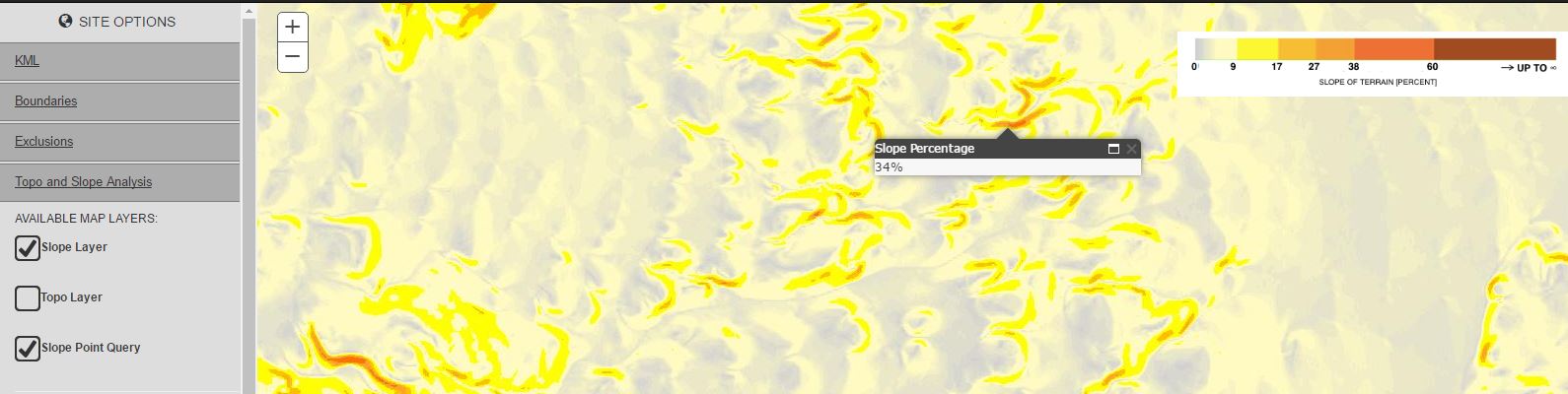
Map layers display useful GIS-powered information for the desired site. Map layers may be turned on/off by checking/unchecking the boxes next to each item. Displayed maps may be panned or zoomed in/out and the information shown will automatically refresh to the new map boundaries.
1- Slope Layer: See a slope heat map of the desired site location by checking/ unchecking this option. A legend on the top right corner of the screen displays the slope percentage values associated with the heat map.
2- Topo Layer: Displays the latest available topographical maps on ESRI’s platform. View is linked to ESRI’s maps which automatically source the highest available map resolutions for any location in the world. Within the United States, the USGS maps provide a 1/3 arc-second (approximately 10m) resolution as a minimum. Elsewhere in the world, the granularity of the topo information varies based upon data availability.
3- Slope Point Query: Display a “spot-slope” of any location on the map by clicking on the desired spot of the map. The slope value is displayed in percentage units.
Elevation Profiles:
An elevation profile of a user-specified path may be displayed on the bottom-right corner of the map area.
1- Click on “Draw Path” to enter the “Elevation Profiles” mode.
2- Start drawing the path by clicking on your desired start point on the map. Click again to end the first path. The elevation profile may consist of multiple paths. Continue adding more paths by single-clicking the desired locations on the map.
3- On the last desired point, double-click the mouse and the system will automatically generate the elevation profile associated with the selected path.
4- To clear the displayed profile, click the “Clear Profile” button.
Generating Automatic Exclusions:
This option allows users to perform a slope analysis on a desired site and exclude parts of the site that fall outside of the buildable slope threshold.
1- Enter the maximum buildable slope in percentage units.
2- Select resolution: Note that the higher the resolution, the longer it may take for the system to auto-generate the exclusions.
3- Click the “Generate Exclusions” button: The system will automatically generate the exclusions associated with the selected site.